Objective:
User wants to import .grd files from Geosoft as a mesh/topography. When they try to import .grd file into the topography or meshes folder as an 'elevation grid', they get error that this is unsupported.
Resolution:
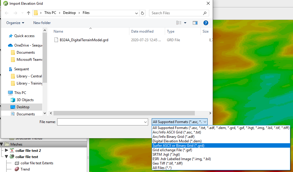
This is currently not supported. We support importing 2D Geosoft grids in the 'Geophysical Data' folder. However the 'import elevation grid' only supports the formats listed in the selection dialog box (see image below). The *.grd file here references 'Surfer' grid files.

We're continually considering new file formats to be supported, we have a feature request submitted with our development team for this.
You can use Oasis Montaj or other software to convert the *grd file into a supported grid format for import using the 'import elevation grid' option.
Notes: