Objective:
I have an aerial photo that I would like to drape over my topography surface.
Resolution:
The following steps assume all the required files are in the Topographies folder.
- View the Topography object in the Scene
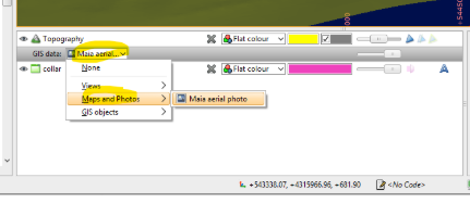
- In the Scene List there is a GIS data drop down menu under the topography object.
- Select from Maps and Photos the required image.
- The image will drape over the topography
- For multiple images, use the Views function

Notes
The image is georeferenced on import
- The "GIS, Maps and Photos" folder holds horizontal (X and Y) images
- The "Cross Sections and Contours" folder can hold any straight image. These can not be draped on the topography object.