Occurrence:
The following error message occurs when attempting to import a TIFF into an Geosoft map.
Display Image:
"The TIFF file ***.tif is not support.
Other errors: Failed to determine grid range".
Resolution:
This error will occur when attempting to import an unsupported TIFF file into a Geosoft map. In most situations, the TIFF will be a 16, 32, or 48-bit TIFF format. Only 8-bit tifs are supported by Oasis montaj or Target.
To resolve the issue you will need to either:
- Convert the TIFF format into an 8-bit format. There are many 3rd party applications that will allow you to perform this action. In some cases, the source application used to produce the image will allow you to select the version of TIFF produced.
- Or convert the TIFF into another image format supported by Oasis montaj and Target. A few good alternatives would be ECW Image (*.ecw) or an ER Mapper image (*.ers).
Root Cause
The version of TIFF you are attempting to imported is supported.
Notes:
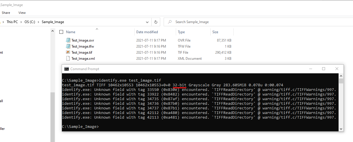
You can sometimes validate the version of the TIFF you have using the Command Prompt. by following these steps:
- Open the Command Prompt
- Navigate to the folder containing the TIFF
- And use this command: identify.exe ***name_of_file***.tif
See example below. In this image I can tell that the TIFF is a 32-bit.
